
What do you get when you combine a fleet of drones with cutting edge machine learning algorithm technology? A new way to create an open source map of the world’s plastic pollution.
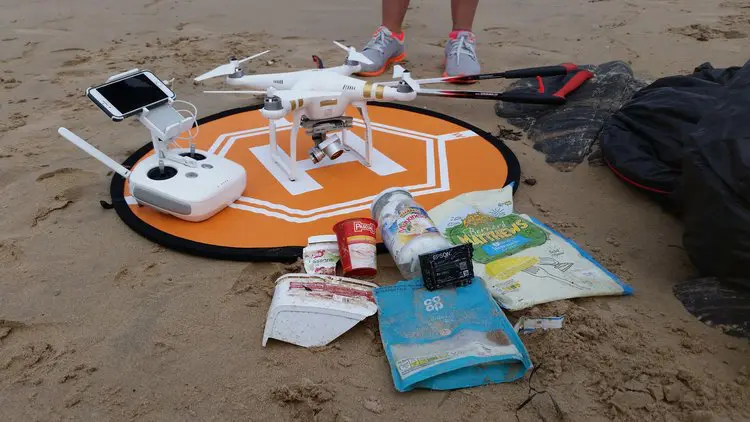
There will be an estimated 1.8 billion tonnes of plastic waste in the oceans by 2050, according to non-profit group The Plastic Tide. The initiative is working hard on finding a solution that may help curb this trend. All eyes of its members are now looking to the sky, where drones have been unleashed to scan the surface for plastic debris.
It is hoped that the innovative use of modern-day imaging technology will allow the drones to detect up to 90% of beach plastics.

From coast to coast
As a first step, the entire coastline of the UK has been analysed in tandem with large-scale beach clean-up operations in April. The new endeavour is called Marine Litter DRONET, and has essentially established a network of drones that yield in-depth information regarding the build-up of plastic waste.
Generating an accurate map of plastic waste is of utmost importance because only about 1% of the waste flow ends up on the ocean surface. ‘The remaining 99% is unaccounted for,’ the group stresses.
A global inventory
‘Our work will significantly enhance our understanding of the amount of plastic on coastlines, by trialing revolutionary drone-based automatic detection of the litter. This will aid the creation of a global inventory of marine plastic pollution, and help identify hotspots, impacts and fate of our plastic,’ comments Dr. Erik Van Sebille, world expert on marine litter and Science Adviser to The Plastic Tide.
Tag along
‘We believe in making our data transparent and available for the public and research communities,’ he adds. As such, the aerial mission is described as an accessible and educational “citizen science project”. Therefore all drone images, algorithms and coding will be open-source. Also, the group aims to host plastic drone survey imagery and algorithm results from around the world.
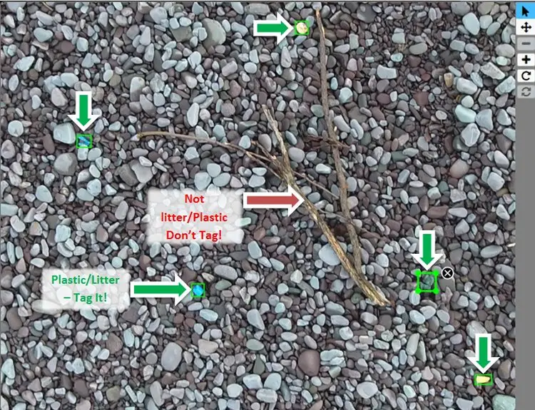
Anyone can join the mission, Van Sebille points out. How? People can help improve the imaging algorithm by tagging and classifying plastic fragments in photos stored in the online database of The Plastic Tide.
Don't hesitate to contact us to share your input and ideas. Subscribe to the magazine or (free) newsletter.